LOCVS
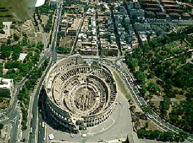
In the valley where the amphitheatre stands today, there is a layer of clay under many metres of sand and silt. Originally the ground level was about 10-15 metres lower than today. Rain and water from streams gathered in the valley, and formed a marsh or a little lake in the depression, depending on the season. From there the waters reached the valley of the Circus Maximus and then the Tiber river. Some drillings carried out recently have demonstrated that the site had been reclaimed in archaic times, with a drain that collected the waters as far as to the Circus Maximus Valley. The site had been certainly inhabited at least since republican times, because remains of many buildings of that epoch have been discovered around the valley. The buildings were expropriated and demolished after the fire of 64 AD, when Nero decided to have there his first residence there (the Domus Transitoria) with a lake, surrounded by buildings and gardens, which we know about from ancient authors.
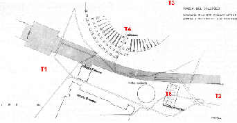
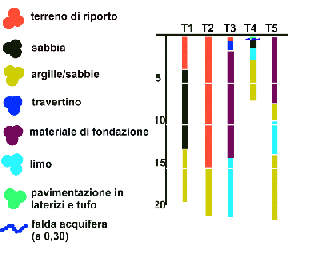
The images below represent (left) the sites of the drillings and the results obtained (right). The map on the left shows the route of the underground line, which, as one can see, winds between the Colosseum and the Arch of Constantine (T5). When the excavation for the underground was made, many ancient drains – and probably also the passage between the amphitheatre and the Temple of Venus - were lost.
 |
 |
The site had advantages, but also drawbacks. One of the main problems was the drainage of the site, but at the bottom of Nero’s lake the engineers managed to reach the clay bed that would support the foundations. Drainage was guaranteed: it was calculated that, even reaching so low a level, the bottom of the arena remains 10 metres above that of the drain.
Moreover, by raising the foundations from the bottom of the lake, the excavation work was reduced, and it was swapped with the easier job of covering the raised foundation with earth and waste materials. The covering was actually carried out with earth and with the waste materials of the surrounding buildings, which were demolished.
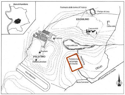
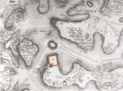
Below: the map on the left (from Storia della città, by L. Benevolo) shows the valley of the Colosseum as it was before it was drained. Note the stream coming from right, which feeds the swamp among the hills. In the top right corner the area of the Domus Aurea, within the city walls, is marked in black. The red rectangles which mark the temple of Claudius are only a reference for the orientation of the maps. The one on the right is by L. Kraatz (Carta Fisica del Suolo di Roma) and it represents the state of the valley in the XVIII century.
 |
 |