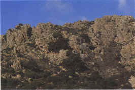
The rocks of Mount Lerno
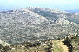
Other view of Mount Lerno
Some geological outlines
The whole territory of the Commune is part of the
enormous granitic complex of the so-called
"Hercynian" cycle of Northern
Sardinia. Particularly around the mountain Lerno, on its
northern side there are microgranitic and leucogranitic
structures as
predominant lithologic elements. This represents a strong
conditioning of the type of soil: there is dark-brown
earth,
above all in the plain parts and the most rocky surfaces,
with rocks that come out of the soil at the highest
parts. Altogether the
territory is prevalently mountainous, with Mount Lerno
reaching a height of almost 1,100 metres above sea-level,
and
most of the rest having a height of about 1,000 metres.
The main river is the "Riu Mannu" which
becomes, after it has passed the
territory of Oschiri, an affluent of the river
"Coghinas". The mounts Unturzu, Molimentos,
Sedda Ottimera, Su Corriadore, Sa Ucca 'e su
Truncu, Sa Muzzere, Filu del su Telalzu on the southern
side, are the natural borders of the river "Rio
Mulinu".