![]()
![]()
Informazioni
meteo Bocche di Bonifacio ![]() Scale
della forza del mare e del vento
Scale
della forza del mare e del vento
| Latitudine | 41.2167 | Longitudine | 9.4000 | Altitudine(feet) | 0 | |||||||||||
|---|---|---|---|---|---|---|---|---|---|---|---|---|---|---|---|---|
| Lat (DMS) | 41° 13' 0N | Long (DMS) | 9° 24' 0E | Altitudine (meters) | 0 | |||||||||||
| metereologia | ||||||||||||||||
Weather Underground for Olbia / Costa Smeralda (19 nm S)
|
||||||||||||||||
| Links aereoporti per altre informazioni - Links for more information | ||||||||||||||||
| ICAO | IATA | Nome | ||||||||||||||
| LIEO | OLB | OLBIA COSTA SMERALDA (19 nm S) | ||||||||||||||
| LIEA | AHO | ALGHERO (61 nm SW) | ||||||||||||||
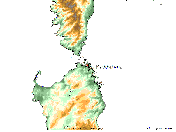 90.3 nm east and west of La Maddalena. Mercator projection.(foto satellite) |
||||||||||||||||
| Previous | Indietro | Meteo Gallura | Nature | Free Stuff - Gratis | ||||||||||||
| Go to Italy General Information | ||||||||||||||||
| Mappa del sito
powered by FreeFind |